Atlantis
Subjects to cover in this page:
The input model for
Atlansis constructed from the subsurface model, groundwater table and elevation data.Time dimensions is categorized in terms of stress periods and time steps (Fig. 1 b). A stress period is the time during which a constant stress is applied (for example the surface water stage in a management area or a surcharge). Within a stress period, time is discretized into individual timesteps. A stress period therefore generally consists of multiple timesteps. A complete model simulation can consist of one or multiple stress periods which may all vary in duration.
In each time step, a consolidation, oxidation and shrinkage calculation is performed and the resulting loss in elevation due to each process is stored.
Core of
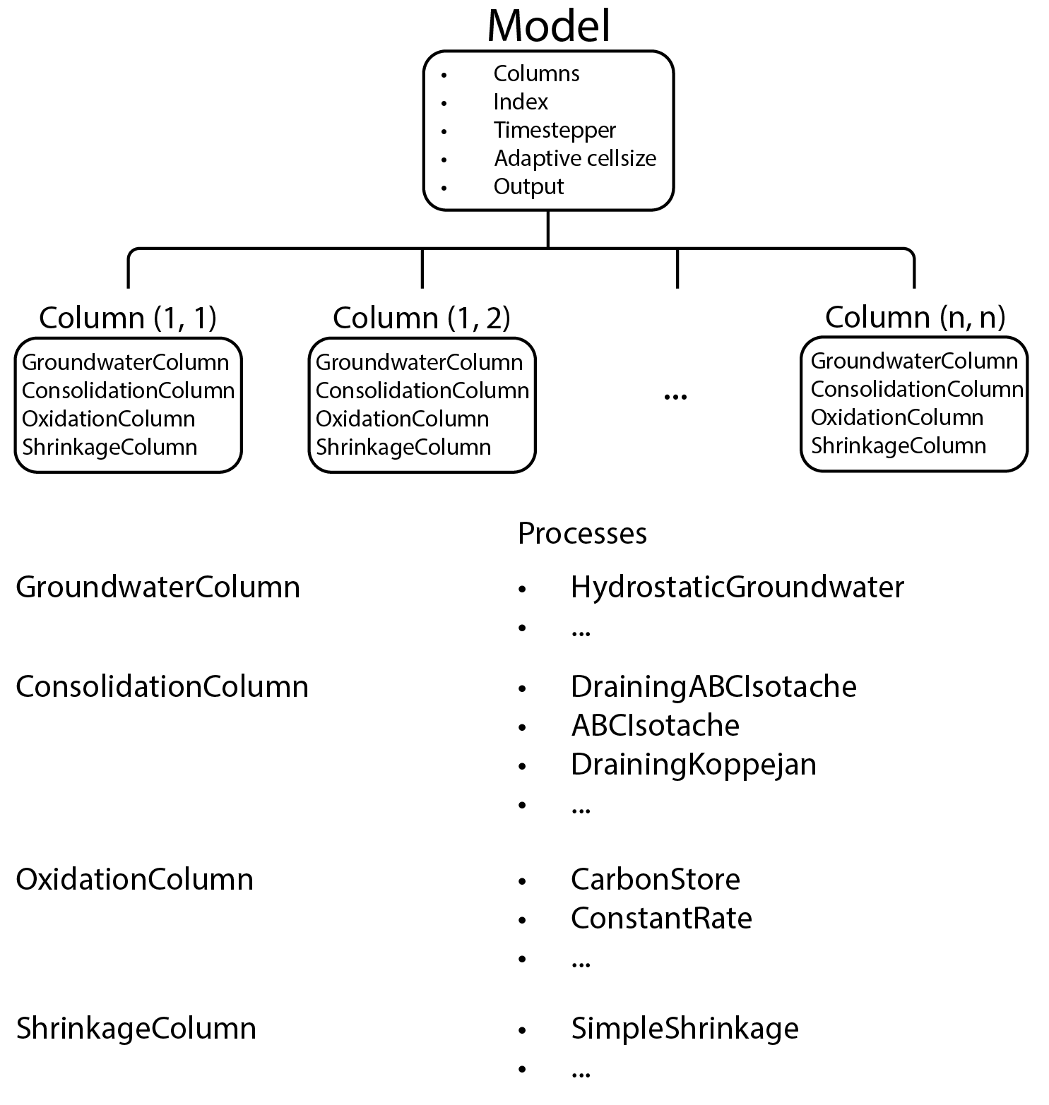
Atlansare the Model and Simulation objectsExplanation of what the model consists of -> a collection of columns consisting of 4 types of columns -> groundwater, consolidation, oxidation and shrinkage columns (maybe include figure of this concept)
Explanation of a column. Only discuss the four components (gw, cons, ox, shr) briefly as this will be covered in the respective pages.
Current calculation methods which are supported by
Atlansand including or ignoring these in the modelling
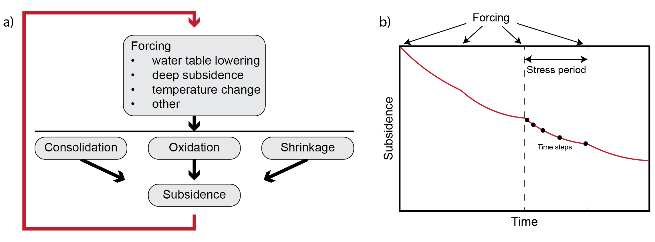
Atlans modelling framework. (a) representation of a single modelling cycle in a stress period. (b) Time discretization of the model in terms of stress periods and time steps. Adapted from Bootsma, Kooi, and Erkens (2020).
Model
The total model area is discretized by a grid of rectangalur cells. The cell size of the grid is depending on the input data and for all cells that have .
Atlans subsurface model that is used for modelling simulations.